people are currently registered to participate in this year's Great California ShakeOut.
are from
the Shasta Cascade area.
Number of Shasta Cascade participants in each category
View names of participants:
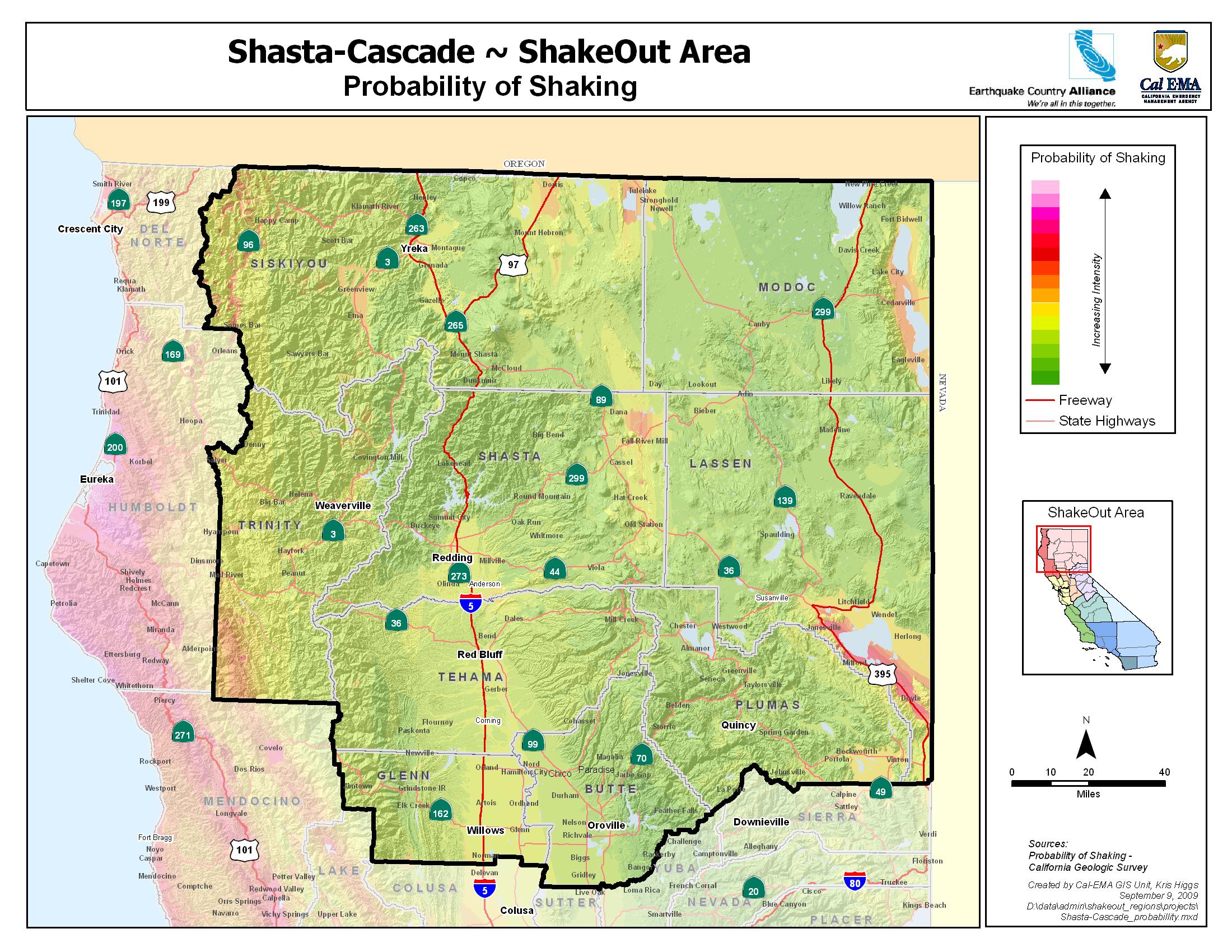
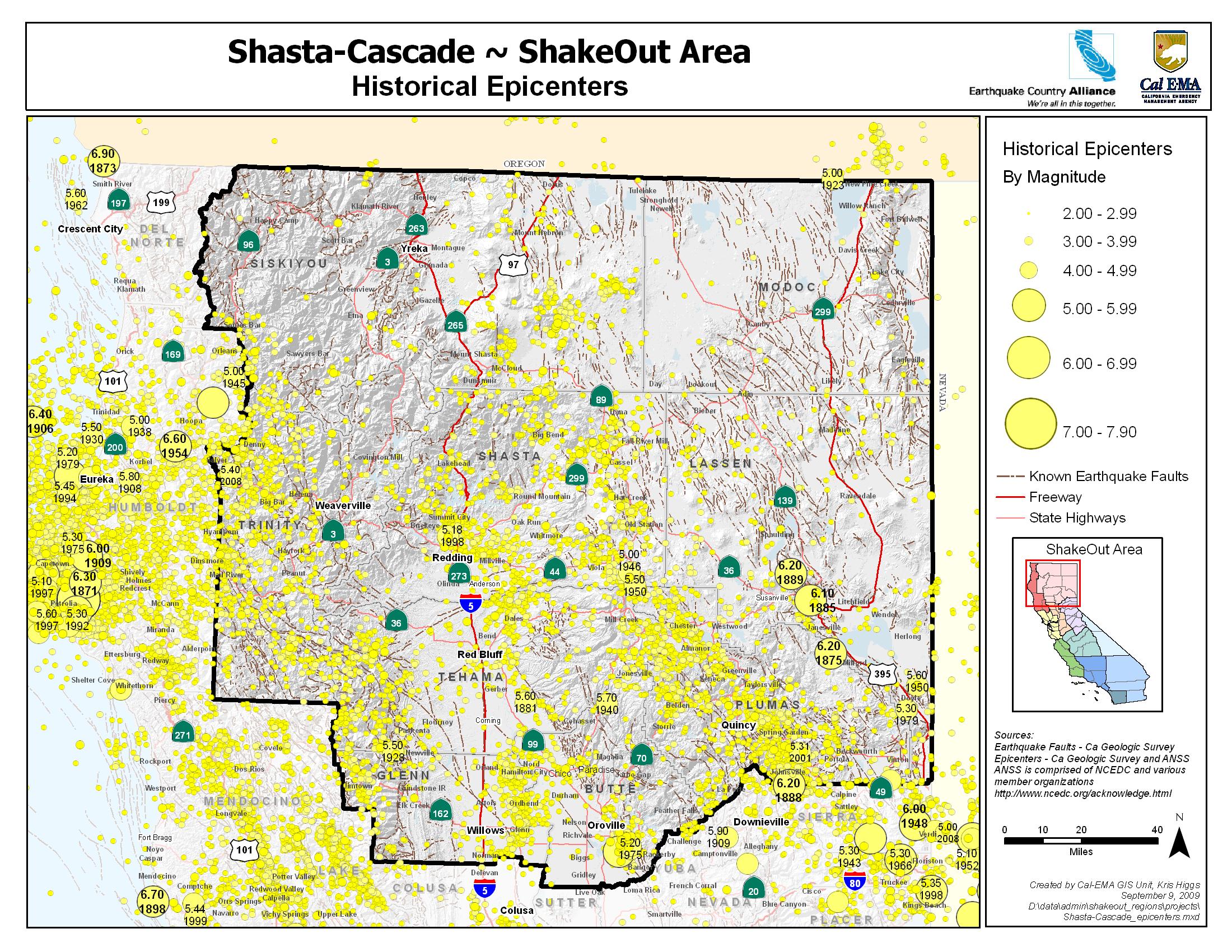
Counties: Butte, Glenn, Lassen, Modoc, Plumas, Shasta, Sierra, Siskiyou, Tehama, Trinity
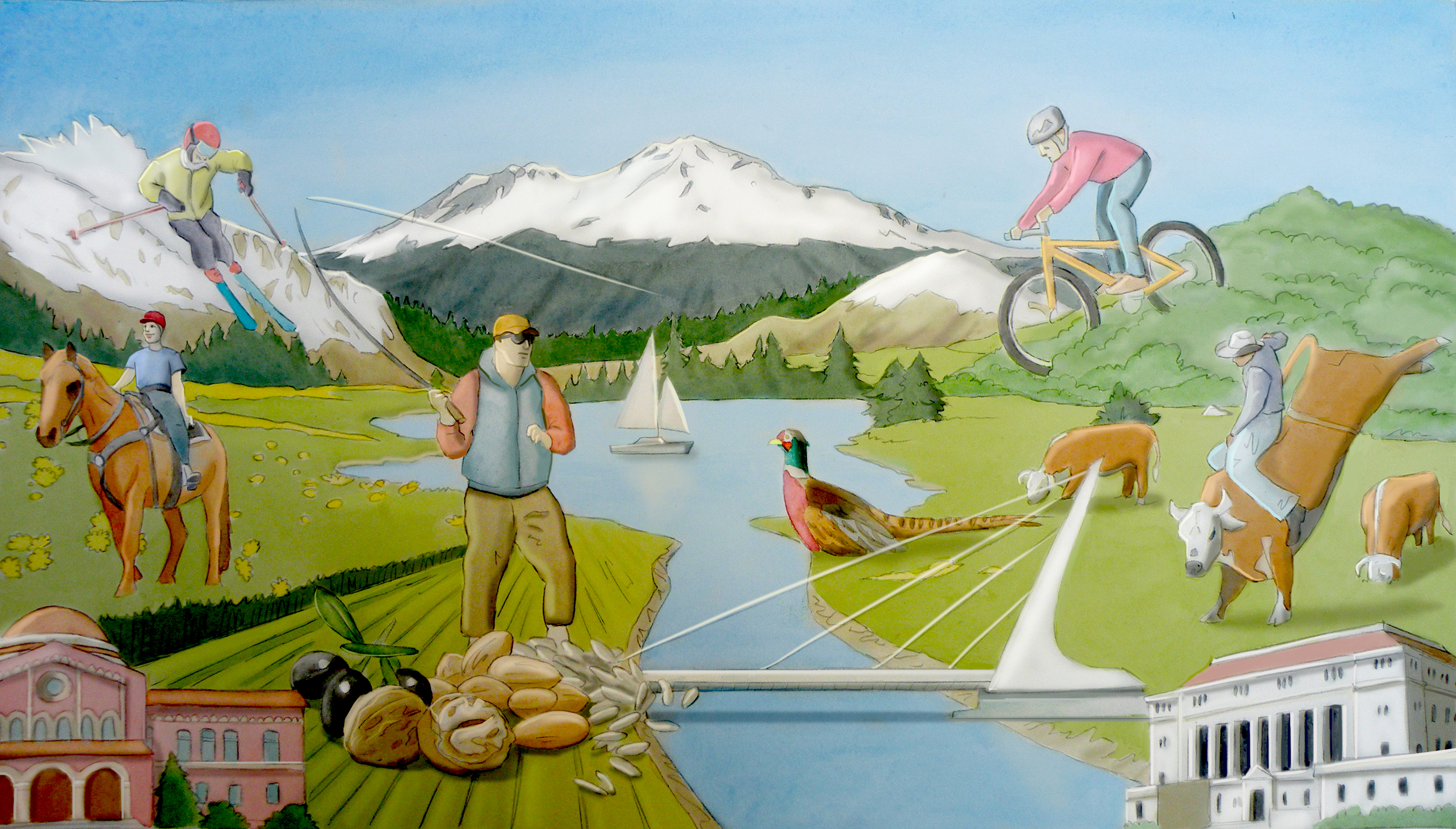
Those who are lucky enough to live in the northernmost part of the state enjoy spectacular scenery and remote vistas. The Trinity Mountains, Modoc Plateau, Shasta and Lassen peaks show how the forces that created them are still shaping the landscape today. But no matter where you live in the Northern and Northeastern parts of the state, you live in earthquake country. Understanding the risks and preparing to survive and recover can help keep you and your family safe.
The Shasta Cascade area may seem remote from the well-known faults in the state such as the San Andreas. It may be a surprise that almost everyone in the region lives within 20 miles of an active fault. The Modoc plateau is a region of both active volcanism and faulting and much of the northeastern part of the state is being stretched apart by basin and range faults. Residents could also be affected by very large earthquakes further away and closer to the coast. It doesn’t take much shaking to trigger landslides that can quickly block roads and highways, isolating the region.
Life After a Big Quake
These earthquakes will disrupt services like electricity, water and sewer, and may limit access in and out of the region. Fire and police departments will be dealing with the most serious situations and may be unable to respond quickly to issues in your community. Government assistance may not be available or not enough to replace your damaged belongings or repair your home. Good news: Preparing now will give you confidence that you and your family will stay safe where the earth shakes.
The Cascade Range has been an active arc for about 36 million years as a result of plate convergence. The southern Washington Cascades are seismically active. Most earthquakes occur along the 100-kilometer-long, north-northwest trending St. Helens seismic zone, where most focal mechanisms show dextral slip parallel to the trend of the zone and consistent with the direction of plate convergence. Other crustal earthquakes concentrate just west of Mount Rainier and in the Portland (Oregon) area. Few earthquakes occur north of Mount Rainier or south of Mount Hood. Description: Cascade Range Volcanoes and Volcanics. United States Geological Survey.
MyHazards
California Emergency Managment Agency
Use this website to discover the hazards that exist in your area and learn how to reduce YOUR risk!
Fault maps, historic earthquakes, how the ground is expected to shake, and much more
California Geological Survey (CGS)
Northern California Earthquake and Tsunami information
Redwood Coast Tsunami Workgroup
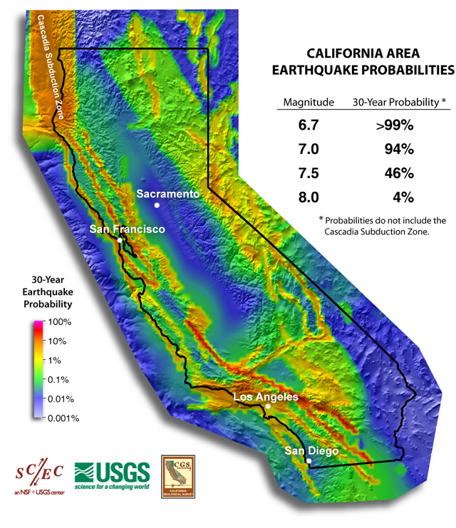
Forecast of California Earthquakes
Southern California Earthquake Center, USGS, and CGS
Earthquake Shaking Potential Map of California (Dec. 2008)
California Geological Survey (CGS)
Maps of recent earthquakes, ShakeMaps for larger earthquakes, email notification, and more
California Integrated Seismic Network
Earthquake and Tsunami Hazards and Mitigation Information
California Emergency Management Agency
For additional information by county, see the following links:
In Butte County: Visit www.buttecounty.net/oem/Home.aspx
In Glenn County: Visit www.countyofglenn.net
In Lassen County: Visit http://www.lassencounty.org/dept/office-emergency-services/office-emergency-services
In Plumas County: Visit https://www.plumascounty.us/88/Office-of-Emergency-Services
In Shasta County:Visit www.co.shasta.ca.us/index/sheriff_index/divisions/oes.aspx
In Sierra County: Visit www.sierracounty.ca.gov
In Siskiyou County: Visit https://www.co.siskiyou.ca.us/emergencyservices
In Trinity County: Visit www.trinitycounty.org